West TNGIC Fall Seminar


An Interactive Overview of ArcGIS Field Applications

DETAILS

When:                   Tuesday, November 15th 2022 | 9am – 3pm

Price:                    FREE

Location:              West Tennessee Ag Research & Education Center
                              605 Airways Blvd, Jackson TN 38301 – Room B

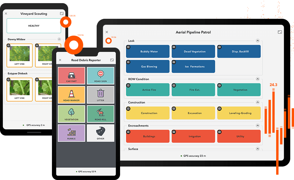
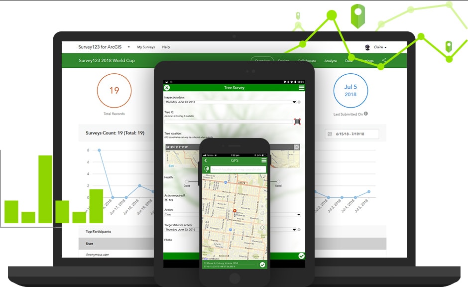
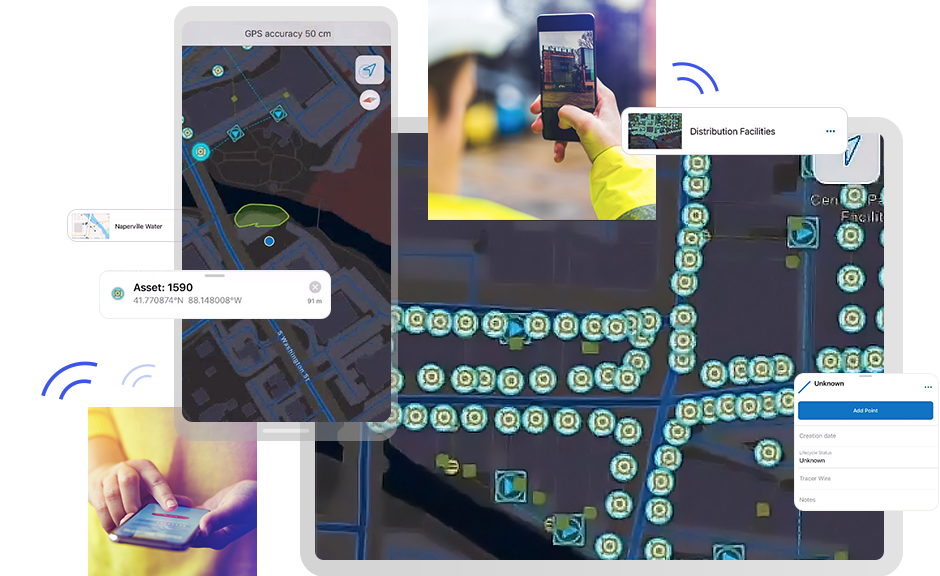
What to Bring:      1) Android or iOS Smartphone or Tablet for LIVE Exercises
                               2) ArcGIS Online Account with Field Worker/Mobile Worker User Type or                                    Higher (this would be AWESOME)

Questions:            [email protected] or 901-476-0234

SCHEDULE

9 AM – 12 PM:  Morning Session – Overview of ArcGIS mobile applications (ArcGIS QuickCapture, ArcGIS Survey123 and ArcGIS Field Maps)

12 Noon – 1 PM:  Lunch Break (Provided)

1 PM – 3 PM:  Afternoon Session – Advanced discussion of ArcGIS Field Maps (offline editing, smart forms, geofences and more)

SEMINAR DESCRIPTION

Esri has a number of applications to enable efficient field editing.  This session will give you an overview of ArcGIS QuickCapture, ArcGIS Survey123 and ArcGIS Field Maps.  The basic functionality of each application and its use cases will be given.  After this session, you will understand which application is most appropriate based on the kind of editing and environment in which you will be working.

EVENT SPONSORSHIP

Your generous support enables us to offer this event to the West TN Geospatial Community (including Middle & East) for free.  Sponsorship tiers include a single TNGIC Regional Event for $250 or sponsor ALL three events for $500.  Your sponsorship includes:

  • Partners will be recognized during the event.
  • Partner logos will be visible on this webpage.
  • Partners will be recognized on the TNGIC social media channels.
  • Partner logos will be displayed throughout the event space.
  • Contact list of attendees

REGISTRATION CLOSED FOR SPONSORSHIPS. THANK YOU TO OUR SPONSORS.

PLEASE NOTE:  After registering as a partner, please register for the event in the section below (Event Registration) for food.

THANK YOU TO OUR EVENT SPONSORS
(All 3 Regions - Duncan Parcell, KCI, G-Squared, True North, WGI)


EVENT REGISTRATION

EVERYONE (including sponsors) needs to register so we can get food.

REGISTRATION CLOSED!!!

Registration Deadline is Wednesday November 9, 2022 - Limit 40 Students


INSTRUCTORS

Mike Sweeney works as a Solution Engineer in the Charlotte regional office of Esri.  He has over thirty-five years of GIS implementation experience in many diverse application areas.  Most of his time is spent exploring and explaining new releases of the ArcGIS software and working with clients in Alabama and Tennessee.  Mike earned a BA in Geography with a minor in Computer Science from SUNY-Albany and a MS in Geography from the University of South Carolina. 

Tim Poe is a graduate and former adjunct professor of GIS at Kennesaw State University.  Tim has worked in State and local government and private sector running GIS shops in large teams and one-man band scenarios.  He is a recovering “full-stack developer” with deep IT knowledge and familiarity in Esri and open-source stacks.  Tim is excited by helping folks move forward be it folks new to GIS and those that are deeply immersed and on the bleeding edge of GIS innovation.  Tim makes his home in Cartersville, Georgia with his wife of 30 years.  His hobbies are writing, mentoring, pro audio, gaming, apologetics, and cooking.